Previous | Table of Contents | Next
3.
Evaluation of Agricultural Potential on Four Additions to Chaco Culture National Park
Anne C. Cully and Mollie S. Toll
¶ 1 The addition of four new land segments to Chaco Culture National Historical Park has offered an opportunity to review aspects of the nature and distribution of archeological sites with respect to the landscape. With the benefit of the previous decade of intensive research at Chaco, the present study was envisioned to provide some substantive evaluation of the ability of the Chaco environment to support its population by farming. Population levels at Chaco continue to be hotly disputed, but must have been at least intermittently substantial to construct and maintain the considerable amount of standing architecture (Lekson 1984), say nothing of live in it. Given widespread doubts about the capacity for central San Juan Basin climatic conditions (particularly precipitation) to sustain agricultural crops with any reliability (Schelberg 1982; Toll et al. 1985), some systematic evaluation of the distribution and extent of ameliorating factors in the landscape is of interest.
¶ 2 Our best understanding of variability in precipitation and frost-free season comes from careful interpretation (e.g., Gillespie 1985; Hogan 1983) of longer-term records than can be gathered in a one- year study; this study places its emphasis on variability in physiography and soils, and how they may influence effective conditions for crop productivity. Topography, hydrology, vegetation, and chemical and physical properties of soils are used as indicators of edaphic conditions affecting plant survival and growth. Our aim has been to identify in these four areas adjacent to the main canyon those constellations of conditions which are likely to allow or limit agricultural production under simple farming techniques (dryland, or supplementation by diversion of runoff water). Mapping each of the survey areas provides a sobering assessment of where and how farming may have been possible; our conclusions leave us wondering again, how life was possible for any concentration of people in the San Juan Basin.
Environmental Background
The Modern Setting
¶ 3 The San Juan Basin is a major geological feature of northwestern New Mexico, with an area of about 40,000 square kilometers, surrounded by mountainous highlands (Fassett and Hinds 1971). The area is drained primarily by intermittent streams; the San Juan River in the northern basin is the major permanent watercourse. Because no permanent surface water sources exist in the central basin area, moisture comes into the area as precipitation and runoff. Annual precipitation is low, averaging about 22.9 cm (9 in.) for the period between 1957 and 1976 (U.S. Department of Commerce 1976), or slightly lower (22.0 cm or 8.5 in.) according to figures cited by Gillespie (1985:17).
¶ 4 The San Juan Basin is in many respects an extension of the Great Basin, although the Chihuahuan Desert region nearby to the south influences the climate and the composition of the vegetation (Shreve 1942). The soils are generally shale and sandstone derived. The vegetation is dominated by members of the Asteraceae or sunflower family, including sagebrush (Artemisia spp.) and rabbitbrush (Chrysothamnus spp.), and the Chenopodiaceae or goosefoot family, especially various saltbushes (Atriplex spp., Browne and Lowe 1980).
¶ 5 The geographical position of the San Juan Basin with respect to atmospheric circulation significantly affects the manifestation within the basin of broad scale climatic changes, as well as climatic variability within the basin and between the basin and surrounding areas. Gillespie (1985:36) describes the San Juan Basin as occupying “a climatically sensitive position near the northwestern edge of the summer monsoonal circulation system [such that] periods of warmer temperatures and strong restricted westerly flow should result in above average summer rain.” Winter precipitation derives from a separate system, originating in the Pacific northwest. Most moisture-bearing storms from this system pass north of the Southwest, but Van Devender and Spaulding (1979) have suggested that cooling trends are responsible for some southward displacement of these westerlies, and thus greater winter precipitation in the northern Southwest.
Paleoenvironmental Conditions Affecting Human Occupation in the Chaco Area
¶ 6 In this section of the chapter, we review climatic and geomorphic trends on a very broad level from the early Holocene to the inception of the Anasazi occupation, and in more detail through the Anasazi and historic periods. A picture of the Chacoan landscape is generated, with specific comments on the four survey areas under discussion here.
Chaco Environment during the Holocene
¶ 7 Several recent studies of San Juan Basin macrobotanical, pollen, and vertebrate remains (summarized in Gillespie 1985) have provided some much-needed information on local conditions during this period of early post-glacial warming. These data indicate environmental conditions substantially different from those inferred from previous studies outside the basin. Presence in packrat middens and dry shelters of conifer needles from species characteristic of montane mixed conifer woodlands (Betancourt and Van Devender 1981; Donaldson 1984), and of bones of small mammals characteristic of mixed conifer or cold desert scrub habitats (Gillespie 1984a, 1984b), point to local conditions both cooler and wetter than today. The extent and distribution of these habitats is still under dispute, but Gillespie (1985) suggests conifers such as spruce and limber pine were present on thin, rocky sediments of the canyon sides, and a sagebrush community on mesa tops. Topographic variability in all four survey areas provides suitable locations for early Holocene mixed conifer woodland species, but the top of Chacra Mesa is the principal candidate for a shrub habitat similar to present-day northern Great Basin plant associations.
¶ 8 Post-glacial warming reached its peak at about 8000 B.P., establishing the general climatic and vegetational regimes we see today. Trees and shrubs disappeared at this stage from what are now deserts and grasslands. More xeric-adapted conifer species (ponderosa and piñon pines) replaced more mesic types present earlier. In Chaco, packrat midden macrofossils dated to the middle Holocene (Betancourt and Van Devender 1981) indicate a piñon-juniper woodland (with occasional ponderosa pine and Douglas-fir) was present, but limited to rocky sediments. Substantial portions of the Chacra Mesa survey area likely supported such woodland cover, and deep rincons on Chacra’s northern edge are suitable locations for ponderosa and Douglas-fir enclaves. Deeper soils on top of Chacra Mesa and the lowland valley floors at all four survey areas likely harbored grassland vegetation (Gillespie 1981).
The Anasazi Occupation (A.D. 550-1250)
¶ 9 Major environmental trends during the Anasazi period correspond with significant shifts in population levels and site distribution. A transition to large Basketmaker III pithouse villages at about A.D. 550 appears to have occurred with improving (more mesic) climatic conditions (Euler et al. 1979). Late Basketmaker and early Puebloan occupation of the San Juan Basin is characterized by settlement of a small number of mid-elevation areas (mostly locations suitable for floodwater farming; Gillespie and Powers 1983).
¶ 10 At approximately A.D. 950 a more pronounced and enduring increase in effective moisture and high summer rainfall occurs with widespread warmer temperatures, all conditions favorable for agriculture (Euler et al. 1979). This ushers in a period of major population increase and site construction, with expansion into a wider variety of habitats, including higher and lower elevations (Gillespie and Powers 1983). Rose et al. (1982) provide some evidence of correlation of major building episodes at the large Chacoan sites with periods of above-average summer precipitation.
¶ 11 Geomorphic conditions during the Anasazi period provided an additional environmental aspect temporarily favorable to floodwater and dry farming. Love (1977) suggests that shallow, anastomosed channels characterized most natural drainage basins in this period. Flow in these channels (concentrated from a wider area) was spread over 30-60 centimeters of windblown sands and silts trapped by vegetation, and kept within root depth of crops by underlying finer-grained alluvial deposits. Large-grained eolian deposits in upland areas during this period also contributed to ready absorption of rainfall. Where such deposits overlaid fine-grained materials, the percolated moisture was again kept within a range useful to plants, while the sands acted as an evaporation-retarding mulch and prevented salts build-up.
¶ 12 An event of critical significance for the short florescence of the integrated San Juan Basin system is a twelfth century drought, dated primarily by tree-ring variation (Rose et al. 1982). This prolonged reduction in summer precipitation (A.D. 1130-1180) correlates with a near absence of building activity in the central canyon. Chaco is no longer the center of the system, and major population centers shift to the river valleys on the San Juan Basin peripheries. This drought appears to have had “an adverse effect on the subsistence economy of the Anasazi, especially affecting small-scale agricultural systems dependent on summer rainfall and runoff” (Gillespie 1985:35).
Potential for Agriculture in the San Juan Basin
¶ 13 Several factors, including low precipitation with high seasonal and annual variation and seasonal temperature extremes, make the San Juan Basin a difficult environment for agriculture. The average of 140 frost-free days in the Central Basin is adequate for the maturation of crops (Tuan et al. 1973). However, this seemingly adequate period is somewhat misleading. Late spring and early fall killing frosts occur frequently, effectively shortening the growing season in many years. Winter precipitation is a significant component of the total in the San Juan Basin, but the summer monsoonal rains provide a large proportion of the rainfall during the growing season with a peak of rainfall in July and August (Tuan et al. 1973).
¶ 14 In spite of the difficult environmental conditions, the recovery of cultigens from many archeological sites in the Anasazi Southwest (roughly the Four Corners area of Utah, Colorado, Arizona, and New Mexico) indicates that agriculture was widespread in this region by A.D. 700 (Donaldson 1982). Reconstructions of prehistoric agricultural systems are based on environmental conditions, surviving remnants of fields and water control systems, as well as ethnographic analogy (see Glassow 1980; Haury 1976; Vivian 1974; Winter 1978; Woodbury 1961). Some water control features appear to be similar to historic systems, while others represent strategies no longer used.
¶ 15 In Chaco Canyon remains of prehistoric agricultural systems include diversion dams, canals, and head gates on the north side of the canyon. These were probably used to supply water to fields from side drainages. Large diversion dams across major drainages have been found at the Chacoan outliers of Kin Klizhin and Kin Bineola (Marshall et al. 1979; Vivian 1974). Many other remains of water diversion facilities have probably been eroded away or buried under aggrading sediments. Thus we are left with very little physical evidence for agricultural systems in the Chaco area. What evidence there is suggests that the Anasazi practiced a number of strategies to exploit concentrated runoff resulting from the high intensity, short-term rainfall that is common in the summer. Hydrologic and hydraulic modeling by Lagasse, Gillespie, and Eggert (1981) suggests that the small water control systems (described by Vivian 1974) are suited to diversion and utilization of local runoff from events from smaller watersheds. Features capable of controlling runoff from the major lateral drainages, or from Chaco Wash itself, have not been verified, and it is doubtful that diversion on such a scale, or true irrigation for that matter, took place during the Anasazi occupation.
¶ 16 Even though there is little physical evidence for agricultural methods, there is abundant archeobotanical evidence at Chaco Canyon for the production and consumption of domesticated crops. Pollen samples from archeological sites at Chaco Canyon indicate that corn (Zea mays) was a substantial portion of subsistence. Corn pollen has been found in 94 percent of 84 samples taken from throughout three sites (Pueblo Alto, 29 SJ629 and 29SJ627), from floor surfaces, storage features, and mealing bins. Percentages of corn pollen in individual samples ranged up to 75 percent of the total grains counted (Cully 1985). Clary (1984) likewise reports frequent and abundant corn pollen in coprolite samples from Pueblo Alto and Pueblo Bonito. Corn pollen was found in all of the 28 coprolite samples and it was the dominant pollen type in 38 percent of the samples. Pollen evidence for the use of cucurbits, or squash, has also been found in storage and living areas at Chaco Canyon (Cully 1985). Phaseolus or bean pollen has not been identified. This lack of direct evidence for the cultivation of beans does not necessarily mean that beans were not grown; beans are self-pollinated and the grains are small, few in number, and could be easily missed in sampling.
¶ 17 Evidence of domesticated crops recovered in flotation samples and macrobotanical remains is also dominated by corn. Corn is clearly the single most abundant plant food taxon found at both large and small Chaco Anasazi sites, particularly when the amount of usable foodstuff represented is considered. Kernels represent only a small portion of seeds recovered (1.4 percent in Pueblo Alto flotation samples, for instance; Toll 1985b), but when all plant parts are considered, corn is one of the most ubiquitous taxa (occurring in 53 percent of Pueblo Alto flotation samples, topped only by two weed taxa, Chenopodium [goosefoot] and Portulaca [purslane]). Corn’s predominance at Chaco sites is most evident among macrobotanical remains, where corn specimens often exceed 95 percent of all vegetal items inventoried in the field. Its artifactual visibility is highly influenced by factors of differential deposition and preservation. Corn’s durable waste product, the cob, is the predominant remnant of the species in both flotation and macrobotanical samples (Toll 1985a).
¶ 18 Beans and squash, by contrast, decompose readily and are less likely to survive carbonization. For beans, threshing away from habitation and cooking by boiling (Kaplan 1956) further contribute to the very low profile of artifactual remains in sites in Chaco and elsewhere. Known Chaco beans have chiefly been recovered unburned from protected locations at Pueblo Bonito and Bc 288; rare specimens from open sites are carbonized (Toll 1985a). Unburned squash rind (including a small percentage of bottle gourd), stems, and seeds have been recovered from roofed rooms at Pueblo Bonito (Toll 1985a); specimens from open sites are rare and usually carbonized. Fragments of corn kernel pericarp, bean epidermis, and squash seeds in coprolites from Pueblo Alto and Pueblo Bonito (Toll 1981) and from Bc 288 (Callen 1977) provide further direct evidence of consumption of these cultivated crops.
Ethnographic and Archeological Perspectives on Parameters Affecting Prehistoric Farming
Topographic Placement and Hydrological Factors
¶ 19 Within most areas of the Southwest, precipitation is not sufficient for dry-farming; Hack (1942) notes that at least 30.5 cm (12 in.) per year are needed. In the absence of permanent water sources, runoff from precipitation often provides the necessary moisture for agriculture. Runoff placement and amount are determined by several hydrological and physiographic characteristics, including intensity and duration of rainfall, catchment area, slope and soil type (Burkham 1967; Hely and Peck 1964). The first three factors affect the amount of precipitation captured by a watershed, while the latter two determine the amount of runoff loss through infiltration. Because so much moisture is absorbed during runoff transport, there is a greater correlation between precipitation and runoff in small watersheds than in larger basins (Fogel 1975). Throughout the Southwest the primary method for combating low, variable precipitation and unequal distribution of surface water is the location of agricultural fields. These are placed with regard to watershed and outflow areas in order to maximize the intermittent water supply without crop damage. A survey of field placement in various areas of the Southwest is appropriate as it illustrates the various strategies that are followed as well as general patterns of location and runoff manipulation. The review of ethnographic data reveals that, while a majority of field types utilize runoff as a water source, alternative methods are also known. Perhaps the most detailed study of field types was made by Hack (1942) in the Hopi area where non-irrigated fields could be divided into floodwater fields (both akchin and floodplain), lateral slopewash fields, and sand dunes.
¶ 20 Floodwater fields are located by a water course and depend on precipitation and runoff to provide adequate moisture for agriculture. Although several varieties of floodwater farming are known, almost all take advantage of the concentrated runoff from large watersheds (Hack 1942; Nabhan 1979). In addition to water, fields receive needed nutrients from sediments deposited during flooding (Bradfield 1971; Hubbell and Gardner 1944). Akchin farming, first described for the Papago by Bryan (1929) is also practiced by the Hopi and Zuni (Cushing 1920; Hack 1942). The fields are placed in the alluvial fans of small drainages where water flow is slowed upon meeting the more level valley floor. Floodplain fields, usually located along larger shallow washes in order to exploit the bank overflow during flooding (Bohrer 1960; Hack 1942), were common in the Hopi area before the current cycle of entrenchment made bank overflow impossible, and thus increased the proportion of akchin fields being utilized (Beaglehole 1937; Forde 1931). Fields in areas of slope wash are infrequent in the Hopi area, as lateral runoff is usually in small quantities.
¶ 21 Not surprisingly, drainage pattern is also the main factor that creates variation in Navajo field locations and farming technology (Bingham and Bingham 1979). Several different types of non-irrigated fields are used by the Navajo, and these may be broken down into categories similar to those developed by Hack (1942). Hill (1938) and Knight (1982) reported four main types of Navajo fields including 1) akchin-type fields; 2) floodplain fields; 3) seepage fields, where groundwater seeps to the surface; and 4) slope wash fields. Increasing erosion in the past century has changed field locations in many areas, often in favor of irrigation farming as erosion imperiled floodwater fields (Hill 1938; Kelley 1982a; Landgraf 1954). Another recent development is the placement of fields below earthen stock dams from which they receive seepage (Kelley 1981; Knight 1980). On the whole, canyon bottoms have been preferred to upland locations (e.g., Lamphere 1977; Landgraf 1954; Shepardson and Hammond 1970). Historically, principal field locations in the eastern Navajo region appear to have been in sandy areas along washes and main channels, as well as in side canyons (Brugge 1980).
Soil Type
¶ 22 Ethnographic reports from Puebloan groups state that soil is an important factor in choosing field locations. Saline and alkaline soils are avoided (Beaglehole 1937; Castetter and Bell 1942; Hack 1942) with the aid of plant indicators (Bradfield 1971). Soils of Hopi and Zuni akchin fields, at the mouths of arroyos on alluvial fans, tend to be sandy and loamy-sand deposits. Soils of floodplain fields are finer clay and silt sediments (Bradfield 1971). Sand dune farming has been observed and studied only among the Hopi (Hack 1942).
¶ 23 For the Navajo, Knight (1982) reports “that the desired soil composition in the McKinley Mine area is a mixture of sand, silt, and clay which soil experts call a silt loam.” According to Hill (1938) sandy loam is the preferred soil type; soil with too much “adobe” (presumably fine clays) was avoided. Other observations in the eastern Navajo country indicated sandy soil along washes (with less permeable soils underlying the sand) was chosen for field locations (Brugge 1980). In Kelley’s (1982b) study on the Gallo Wash Mine Lease Area, an informant stated that her parents would look for a wet spot with sandy soil. Near Bis sa'ani Pueblo, Navajos interviewed stated that sandy soil is preferred (Cully et al. 1982). Some clay may be desirable, but too much prevents penetration of moisture.
Vegetative Indicators
¶ 24 Ethnographic sources state that vegetation is used to some extent to choose field locations. Castetter and Bell (1942) note that the Papago often planted in areas of dense vegetation cover. Three plant communities (blacksage, Green’s rabbitbush, and greasewood) indicated potential arable land in the Hopi area (Bradfield 1971), while other plants often indicated areas of high alkalinity (e.g., annual saltbushes, alkali sacaton). For the Navajo in general, studies suggest that selection of field location was made on the basis of slope, drainage, and soil type, with vegetation type being of lesser importance (Bingham and Bingham 1979; Kelley 1982a, 1982b; Knight 1982). Knight (1982) mentions that some people avoid places where knotweed (Polygonum aviculare) or bindweed (Convolvulus arvensis) grow. Hill (1938) cites plants as a negative indicator; people avoided planting in dense trees or brush, presumably to save labor in clearing the land. During the ethnographic research associated with the Bis sa'ani Community study (Cully et al. 1982), informants noted that bigger sagebrush plants than in surrounding areas and the presence of large greasewood plants in a particular location may indicate a good place for fields, as these reflect water availability and desirable soil types.
Methods
¶ 25 The evaluation of potential arable land in the Chaco additions survey areas required the mapping of topographic and vegetational aspects of the modern environment that we believe would have been critical to agriculture. Previous ethnographic and environmental studies have shown that in the Southwest, the availability of ephemeral water is the primary consideration, given the common case of precipitation levels below the minimum required for successful farming. Thus, a critical factor in our assessment of agricultural potential at the Park additions has been the placement of land in relation to runoff collection.
¶ 26 Another primary consideration is the chemical and physical suitability of soils within the study areas for agriculture. In the San Juan Basin a large part of evaluation of soils with respect to farming possibilities involves identification of soils not capable of sustaining a crop to harvest. Unsuitable soils include areas of high salinity and alkalinity, and those with high clay components. Soil texture with a balance of permeable sands and fine, moisture and nutrient-attracting clays is desirable.
¶ 27 A third vital factor in our evaluation of the arable lands within the study areas was the identification and description of vegetation types. Highly saline or alkaline soils are indicated by the presence of tolerant plant species; for example, shadscale (Atriplex confertifolia) and broadscale (A. obovata) are distinctive saltbush species that occur primarily in heavy, alkaline soils that may be unsuitable for agriculture. Plant species may also indicate soil conditions favorable for agriculture. Winterfat (Eurotia lanata) is an indicator of non-saline soils, while sand dropseed (Sporobolus cryptandrus) and Indian ricegrass (Oryzopsis hymenoides; now referred to as Acnatherum hymenoides) prefer sandy substrates. Extensive stands and large individuals of big sagebrush (Artemisia tridentata) indicate loamy, relatively non-saline soils (Kearney and Peebles 1964).
Mapping
¶ 28 Agricultural units were defined using the criteria of placement of land in relation to runoff collection and vegetative indicators of the suitability of soils for agriculture. Mapping these important aspects of the modern environment included field surveys at each park addition, examination of aerial photographs (at a scale of 1:3000), and examination of field maps, notes, and photography in the laboratory to make final determinations of unit boundaries. On-the-ground surveys were conducted at each of the park additions in October 1985. At this time, rough maps of topographic characteristics and the associated vegetation types were made. Distinctive patterns on the aerial photographs were identified on the ground and recorded for later use in the final mapping. Final mapping was done using field maps, notes, and aerial photography. The final maps, at a scale approximately the same as the aerial photos, include topographic features, the associated vegetative types, and the designation of agricultural potential as being good, fair, or poor. A description of each vegetative and topographic type is provided in Table 3.1 along with the percent it composes of each survey area. The physical distribution of the vegetative and topographic types is shown in Figures 3.1 to 3.4. Appendix 3.1 provides photos of vegetative/topographic types in each survey area.
Table 3.1. Hectares of vegetative/topographic types by survey addition.
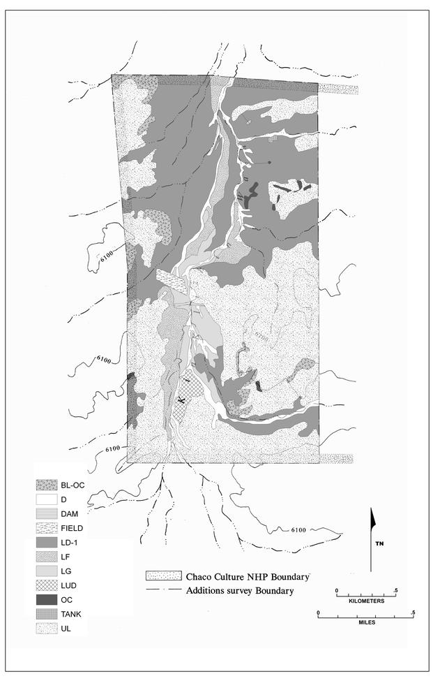 |
Figure 3.1. Kin Klizhin topographic and vegetative types. |
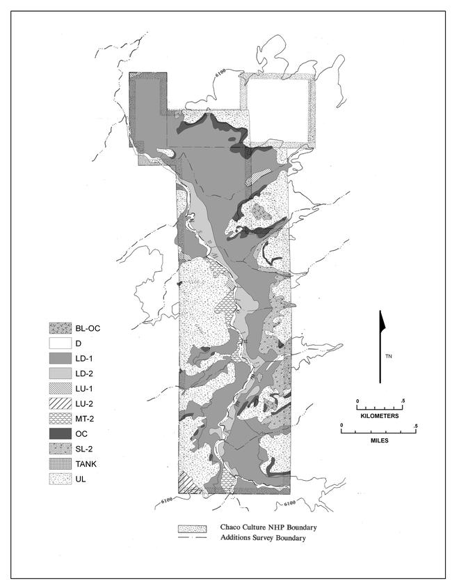 |
Figure 3.2. Kin Bineola topographic and vegetative types. |
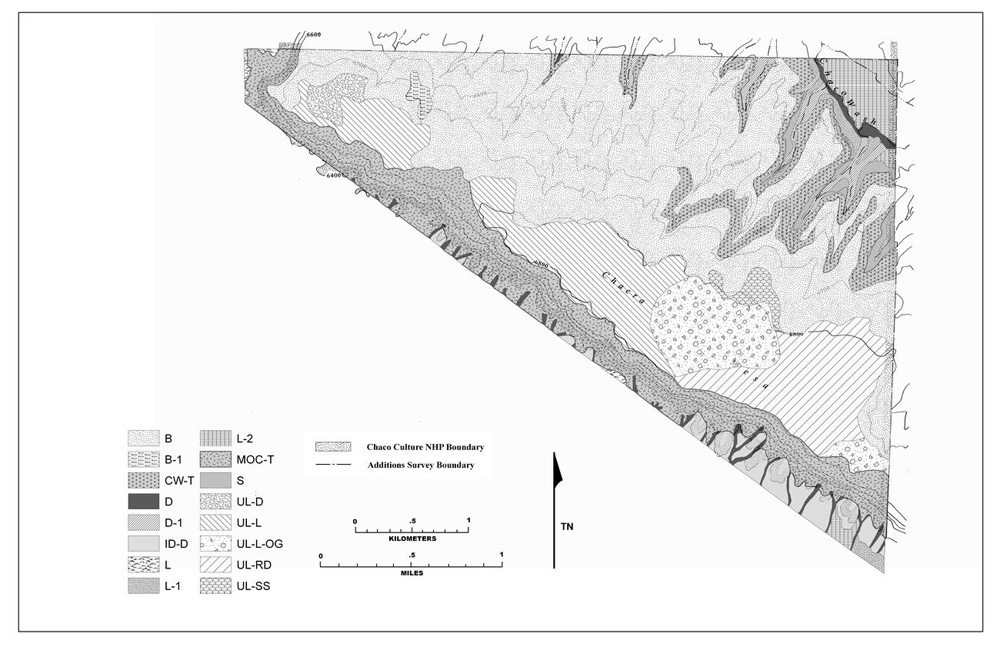 |
Figure 3.3. Chacra Mesa topographic and vegetative types. |
 |
Figure 3.4. South Addition topographic and vegetative types. |
Soil Samples
¶ 29 While the general condition of the soil can be understood by observing the vegetation, laboratory analysis of soil samples provides precise data on soil texture, organic matter content, salinity, and alkalinity, all factors that relate directly to the agricultural potential of the land. Soil texture, or the relative proportions of sand, silt, and clay particles, is important in aeration of roots and availability of nutrients and water. Clays retain water and nutrients, whereas soils high in silts and sands have larger pore spaces that can result in percolation of water and leaching of nutrients beyond the reach of the plant roots. However, larger soil particles retard the compaction of clays that harm plant roots, and prevent penetration of moisture. Organic matter has a high capacity for adsorption of nutrients and water. It reduces undesirable compaction and consequent poor drainage and aeration. The texture of a soil influences the quantity of water and air and the percentage of humus within it. Sandy soils, with greater percolation rates, have less organic matter than finer soils. A balance of coarse and fine soil particles is desirable in an agricultural soil, although a shallow, sandy soil with an underlying impermeable clay layer to retain moisture and nutrients in the root zone can have agricultural potential.
¶ 30 In the arid Southwest, low rainfall retards soil leaching so that soil pH is often high; at pH values slightly above neutral (7.2), iron and trace elements such as manganese, zinc, copper, and cobalt are less available; at pH values around 8.4, the nutrient phosphorus becomes less available; and as pH approaches 9.0, calcium and magnesium become unavailable. At salinity values (electrical conductivity of the soil solution in millimhos per centimeter) greater than 4 mmhos/cm, there is sufficient concentration of soluble salts (chlorides and sulfates of sodium, calcium, and magnesium) to interfere with the growth of most plants (Brady 1974).
¶ 31 Fourteen samples of soil within approximately 5 cm of ground surface were collected from locations on the park addition lands that we felt had agricultural potential: three from the top of Chacra Mesa, four from drainages at the base of Chacra Mesa, four from the South addition, two from Kin Bineola, and one from Kin Klizhin. Ideally, additional soil samples should also be taken from within areas that we considered unsuitable for agriculture. Budget constraints did not permit this, however, and soil sampling was limited to the areas considered to have agricultural potential.
¶ 32 These comparative data have assisted us in determining the validity of the designations of suitable areas. Of these areas, a high proportion of soil samples were taken from Chacra Mesa, where there was a diversity of land and vegetation types with fair to good agricultural potential. The description of sampling locations is found in Table 3.2. The samples were analyzed for organic matter, textural composition, salinity, and pH at the Tesuque Watershed Laboratory, Biology Department, University of New Mexico.
Table 3.2. Results of soil sample tests for Chaco Additions survey areas.
Results
Physical and Biological Characteristics Relevant to Prehistoric Farming Potential in the Four Survey Areas
¶ 33 The addition lands at Kin Klizhin and Kin Bineola share several major physiographic characteristics (Figures 3.1 and 3.2). Each has a large, intermittent drainage running through it, with broad floodplains adjacent to washes. Gentle slopes and small drainages extend from neighboring escarpments of shale and sandstone outcrops to the floodplain. Atop these escarpments are broad upland areas.
¶ 34 Within the floodplains, the vegetation is characterized by a mixture of saltbush species (Atriplex spp.), black greasewood (Sarcobatus vermiculatus), and Indian ricegrass (Oryzopsis hymenoides). The dominant species are those that can tolerate alkaline and saline conditions in clay soils; these include shadscale (Atriplex confertifolia), broadscale (A. obovata), and alkali sacaton. The vegetation of the slopes and side drainages is characterized by a similar set of plant species, but the dominance shifts to those more characteristic of sandy soils, such as Indian ricegrass and sand dropseed. The upland vegetation is composed of grasses and shrubs, including galleta grass (Hilaria jamesii), snakeweed, Green’s rabbitbush, and rubber rabbitbrush (Chrysothamnus greenei and C. nauseosus) and occasional winterfat (Eurotia lanata).
¶ 35 Chacra Mesa and South Addition are similar to one another in several ways; the areas encompass rocky sandstone outcrops and rincons with minor drainages (Figures 3.3 and 3.4). At Chacra Mesa, a significant portion of addition lands are located on the upland table, where grasslands are dotted with juniper (Juniperus monosperma) and an occasional piñon pine (Pinus edulis). The mesa drops off in a series of bench formations to the floodplain of the Chaco Wash below. Steep-sided small canyons or rincons have formed in the sandstone, and these contain a variety of vegetation types. At the base of the canyon walls, squawberry (Rhus trilobata) and little bluestem grass (Andropogon scoparius) are found; Mormon tea (Ephedra spp.), rabbitbrush, Indian ricegrass, and sand dropseed occur on the lower talus, and saltbush and alkali sacaton dominate the rincon bottoms. A small portion of the Chaco Wash floodplain is included in the new addition, and the vegetation is dominated by alkali sacaton, saltbushes, and black greasewood.
¶ 36 At the South Addition, the land within the boundaries of the study area consists primarily of rincons similar to those at Chacra Mesa. Rocky outcrops and the uplands directly above these rincons are for the most part excluded from the addition.
Evaluation of Agricultural Potential in the Four Survey Areas: Ranking of Specific Types Within Each Survey Area
Lands with Poor Agricultural Potential
¶ 37 Lands were judged to have poor agricultural potential for several reasons. Areas were placed in this category if there were vegetative indicators of salinity and alkalinity, if the soils were highly eroded, or if the lands were situated to receive little runoff.
¶ 38 At Kin Klizhin and Kin Bineola, the upland land types occurring on mesa tops and higher elevations form a high percentage of the total (Figures 3.1 and 3.2; Table 3.1). The somewhat sandy soil supports a grassy shrubland, dominated by alkali sacaton (Sporobolus airoides), sand dropseed (S. cryptandrus) and Indian ricegrass (Oryzopsis hymenoides). In terms of soil type, the uplands would be hospitable to agriculture. However, their topographic position prevents large scale water collection from runoff. Since there is inadequate rainfall for dryland agriculture, the uplands probably would not have served as major agricultural locations. In historic times, the uplands have been excellent grazing areas, however, and continue to be valuable to Navajo people for forage for their livestock.
¶ 39 The upland areas at Chacra Mesa are characterized by piñon, juniper and grasses, including Indian ricegrass, needlegrass (Stipa sp.), blue grama grass (Bouteloua curtipendula) and shrubs like Bigelow’s sagebrush (Artemisia bigelovii), Mormon tea (Ephedra spp.), and broom snakeweed (Gutierrezia sarothrae). The grass cover appears to be abundant, and the mesa has been used for sheep and cattle grazing. At the South Addition, upland areas and mesa tops were not included within the addition boundaries (Figures 3.3 and 3.4).
¶ 40 Minor components of the total area of the four additions include the drainages, sandstone or badland outcrops, steep dune areas, slopes, and other areas with poor soil conditions and/or placement in situations where it would be difficult to divert water. Some of these types may have been of indirect importance to agriculture, however. On outcrops that are bare of soil and vegetation, runoff is high in comparison to areas with an accumulation of soil and the attendant water retention capacities. Drainages below these areas gathered and concentrated water from a large area, and with proper engineering this moisture could have been directed to agricultural land.
Lands with Fair Agricultural Potential
¶ 41 We considered lands to have fair agricultural potential if the vegetation indicates appropriate soil conditions, and if erosion was not extreme. Topographic placement was an important factor if the watershed was small, or if directing water to fields appears to have been difficult. Then we judged the lands to have fair rather than good potential for agriculture.
¶ 42 At Kin Klizhin and Kin Bineola, several major Lowlands land types have fair agricultural potential (Figure 3.1; Table 3.1). Topographically, the lowlands are in a position to receive runoff from local precipitation and from the major drainage of each area (Figure 3.2). This water could be controlled and directed to fields in the valley bottoms. At Kin Klizhin, the most promising of these areas is the LF unit dominated by fourwing saltbush (Atriplex canescens) indicating soil conditions favorable to agriculture. These lands are somewhat eroded. At Kin Bineola the dissected LD-2 and undissected LU-2 lowlands are also somewhat eroded, but the dominant vegetation, fourwing saltbrush and black greasewoood (Sarcobatus vermiculatus), suggest more favorable soil conditions and a high water table. Indeed, both of these areas appear to offer more agricultural potential than at Kin Klizhin.
¶ 43 Somewhat less promising, but accounting for the great majority of lowland at both Kin Klizhin and Kin Bineola, are LD-1 lands. Much of this unit in both areas is badly dissected by erosion, and at least in the modern setting seems unsuitable for agriculture. The vegetation in this area is sparse, and dominated by various species of saltbushes (Atriplex obovata and A. confertifolia) that tolerate soils with high salinity and alkalinity levels. However, as will be discussed in the conductivity analysis, there is no firm evidence at present to indicate high alkalinity or salinity in soil surface levels within this unit at either Kin Bineola or Kin Klizhin, although more soil testing is needed.
¶ 44 The Mesa Toes type at Kin Bineola is composed of sandy soils. This is reflected in the vegetation, which is dominated by broom snakeweed, rabbitbrush, and sand dropseed. These areas could have been watered by directing runoff from local precipitation.
¶ 45 At the South Addition and Chacra Mesa, fields placed in the lowland areas found in the rincons would have benefitted from local precipitation from a wider catchment area. Soil conditions in the Lowlands area at South Addition would probably be adequate for agriculture. The lowland areas would have received water only from side drainages. Lands to the east of the additions boundary adjacent to the drainage running through Fajada Gap may have better agricultural potential because of access to a larger water supply.
¶ 46 At Chacra Mesa, the Lowlands within the rincons were deemed to have fair agricultural potential because of favorable soil conditions and local runoff available from the sandstone rincon walls. A second type, Uplands with sandy soil, was found somewhat below the top of Chacra Mesa, where soil conditions are favorable and some runoff water would be available.
Lands that are Good for Agriculture
¶ 47 To be considered good for agriculture, the lands had to have vegetative indicators of suitable soils, exhibit little erosion, and be placed to receive runoff.
¶ 48 Lands with good agricultural potential at Kin Klizhin and Kin Bineola are a very minor component of the total (Table 3.1). The vegetation within this Lowlands type provides evidence for soil conditions that would be suitable for agriculture. Fourwing saltbush has been used to indicate adequate moisture and suitable soil conditions for fields (Kelley 1982b) and Indian ricegrass occurs in locations where soil is at least somewhat sandy. For the most part at Kin Klizhin, this type lies next to or nearby the main wash, and thus is in an excellent position to receive runoff water. The modern Navajo field that is found within the addition boundaries appears to have been located in this land type. At Kin Bineola, the undissected lowlands are located with the same relation to the major drainage, and the vegetation indicates favorable soil conditions (Figure 3.2; Table 3.1).
¶ 49 The shallow, unincised drainages in rincons at both the South Addition and Chacra Mesa appear to be good locations for agriculture (Figures 3.3 and 3.4; Table 3.1). Water in these drainages could be spread or diverted easily and the danger of washing fields away with intense runoff would be less than in a major drainage like Chaco Wash, or those at Kin Klizhin and Kin Bineola.
¶ 50 At Chacra Mesa, the Bench area, intermediate between the mesa top and the rincons below, offers good potential for agriculture, with favorable soil and the possibility of collecting runoff from the upper levels (Figure 3.3; Table 3.1). Soils here are largely sandy.
Soils
¶ 51 Soil samples were taken from various locations in the study areas (Table 3.2). All of the samples were taken from locations that were within areas we felt had fair or good agricultural potential, although soil sample 12 was taken in the dissected lowlands at Kin Bineola characterized by sparsely distributed saline tolerant shrubs.
Organic matter
¶ 52 Organic matter is vital in the makeup of soils. Valuable nutrients are adsorbed to the surface of organic matter particles and are readily available to plant roots. The moisture retention of a soil is greatly enhanced by organic matter, and shrinking and swelling of soil around delicate root hairs is also reduced. In desert soils this important constituent is in short supply. Litter, the primary source of organic matter, lies on the surface rather than becoming incorporated into the soils near the source, and is largely lost to wind and water erosion. Runoff water can contain high levels of organic matter that become concentrated in areas where the water slows down, dropping particulate content. In areas of the Sonoran Desert, Nabhan (1979, 1982) sees this source of yearly soil nutrient renewal as the key element in the success of Tohono O'odham (Papago) floodwater farming.
¶ 53 Areas like the silty wet spot (Table 3.2, sample 10) in the South Addition receive runoff with organic matter and fine sediments from a larger catchment area, and both build up to relatively high levels. Other locations with relatively high levels of organic matter are the field at Kin Klizhin (Table 3.2, number 14), and the main floodplain of the Chaco Wash near Chacra Mesa (Table 3.2, sample 7). These areas would consistently receive organic matter from runoff over the years.
Soil texture
¶ 54 Sand, silt, and clay content of each soil sample were measured. Most samples had relatively high percentages of sand (Table 3.2). Several samples were, however, dominated by clay fractions. They were from a low lying drainage (Table 3.2, sample 7, Chaco Wash floodplain), the silty wet spot at the South Addition (Table 3.2, sample 10), and the agricultural field at Kin Klizhin (Table 3.2, sample 14).
Conductivity
¶ 55 Conductivity, a measure of soil salinity, ranged from 0.62 to 0.224 mmhos (Table 3.2). While these results are not directly comparable to those derived by the Soil Conservation Service (SCS)1The former Soil Conservation Service is now known as the Natural Resources Conservation Service for the area (Table 3.2), they are useful in relative comparisons between sampling locations in this study. Interestingly enough, the highest conductivity value is found in the sample (#14) from a modern Navajo agricultural field at Kin Klizhin. Increasing levels of salinity are often cited as the effect of irrigation in arid lands, eventually rendering the land useless for agriculture (Israelson and Hansen 1962). Some accumulation of salts in this location may be attributable to farming practices over time. However, salinity levels may vary throughout the year or from year to year, depending on precipitation and flood events. If adequate precipitation falls, or flooding occurs, salts may be washed down to the caliche layer or off the site (Brady 1974, Tommy Parham, Soil Conservation Service, personal communication, 1987).
¶ 56 The soil sample (#12) from the dissected lowland at Kin Bineola that we assigned to the fair agricultural potential class had the second highest level of conductivity (Table 3.2). At both Kin Bineola and Kin Klizhin, water and sediments from badland outcrops may affect the areas receiving the runoff. The Soil Conservation Service reports that Notal soils, present at Kin Bineola, are derived from sandstone and shales and may have relatively high levels of sodium (Keetch 1980). Table 3.3 shows the range of conductivity levels for Notal soils are from 4-8 mmhos/cm; at 4 mmhos/cm some crop plants may be affected (Brady 1974). Blancot soils at Kin Klizhin may be derived from sandstone and shales, but in general sodium levels are lower (Keetch 1980).
Table 3.3. Background soil data (Keetch 1980) for Chaco Additions survey areas.
¶ 57 While there are suggestions of potential problems in the Kin Klizhin and Kin Bineola areas as indicated by the presence of saline tolerant shrubs, there do not seem to be serious impediments to agriculture from soil salinity at any of the locations sampled. Dr. Carl White (personal communication, 2011), Research Associate Professor of the Biology Department at the University of New Mexico, believes that results from samples #12 and #14, analyzed at the Tesuque Watershed Laboratory, are likely equivalent to 2-4 mmhos/cm, under the methodology used by the Soil Conservation Service. It is worth noting however, that the samples reflect conditions near the soil surface, and are not necessarily indicative of salinity levels in the plant rooting zone. Additional soil samples from the outlier areas, including samples from the root zone, could shed light on the true agricultural potential of soils in these survey areas.
Soil pH
¶ 58 Soil pH values were surprisingly close to neutral (Table 3.2). This soil parameter is probably not an important inhibiting factor to crop growth and production at Chaco. Iron and some trace elements may become less available to plants when soil pH is slightly above neutral (pH 7.2). To plants under moisture stress, this may become a critical problem.
Comparison to Soil Conservation Service Soil Data
¶ 59 Kin Klizhin and Kin Bineola are located within the Blancot-Notal and Sheppard-Huerfano-Notal soil classifications (Keetch 1980). Our soil sample from Kin Klizhin at the south end of the Navajo field is similar to the Notal soil type, with a pH somewhat lower than the range given for Notal soils (Table 3.3). The salinity level at the field is considerably higher than other soil samples in our study, but it is still not high enough to restrict crop production, as indicated by modern Navajo use.
¶ 60 At Kin Bineola, the clay flats and eroded dune edges are most like the Blancot soil type in percent clay, though pH values are somewhat lower than that given for Blancot soils. At the clay flats, the salinity value is much higher in sample 12 than most other samples. Of the two, the dune edge sample is lower in salinity.
¶ 61 In the South Addition, soil samples we took from gentle drainages, silty wet spots, and duney flats are most like Huerfano and Notal soils (Table 3.3). At Chacra Mesa, our soil samples were generally sandier than the Doak-Avalon and Blancot-Notal soils (Table 3.3), and pH values were lower.
¶ 62 While Soil Conservation Service soil maps are valuable sources of information, comparison of soil sample data to the Soil Conservation Service classification indicates that there is a great deal of variability within major soil types. In assessing the potential of small scale runoff agriculture, one must deal with environmental conditions on a smaller scale.
Discussion
Agriculture at Kin Klizhin and Kin Bineola
¶ 63 The new additions at Kin Klizhin and Kin Bineola encompass large drainages and rincons with smaller tributary drainages. The park boundaries at both areas include substantial portions of landscape that could be used for agriculture given their topographic placement. Akchin type fields could be placed at the mouths of rincons where runoff from local precipitation could be used. Local runoff could also be directed to the gentle slopes and mesa toes along the rincons. Runoff from a larger watershed could be used by damming the wash (as seen at Kin Klizhin and probably Kin Bineola), and causing overflow water to flood fields adjacent to the wash. If the drainage was shallow during the Anasazi occupation, this overflow might happen naturally and the water could be directed to fields by spreaders. Runoff from the shale and sandstone outcrops would be great, but the salts load from the badlands might contribute to soil salinity levels.
¶ 64 At both Kin Klizhin and Kin Bineola, however, there may be problems with soil salinity and erosion. By our estimates, only a very low percentage of the total lands within each addition would be good for agriculture under present conditions, and we estimate that only low numbers of people could have been supported. However, we do not know what changes have taken place over time. Severe erosion may have caused some of the lowlands to become unsuitable for agriculture because of either soil loss or because of massive sediment deposition. In prehistoric times, more of the lowlands may have been cultivable. On the other hand, conditions may have been similar to today’s. A geomorphological study would be invaluable in determining how conditions within these floodplain areas may have changed. Until we have that information, estimates of agricultural potential probably should remain conservative.
¶ 65 There are several characteristics revealed by the soil samples that are positive for agriculture. There is a substantial percentage of organic matter in the sample from the modern Navajo field at Kin Klizhin and the sand fraction is higher than expected at Kin Bineola. The pH values are generally lower than we expected. It would be interesting to learn whether the field’s productivity has declined over the years, and whether or not increasing salinity was a factor in deciding not to farm this field recently. The predominance of saline-tolerant plant species at Kin Bineola and Kin Klizhin indicates high salinity at the root zone. However, our samples from near the surface did not contain harmful saline levels. If reports from local Navajo farmers (and further soil testing) indicate agriculture here can be productive in spite of possible salinity problems, then our estimates of agricultural potential at Kin Bineola and Kin Klizhin have been too low.
Agriculture at the South Addition and Chacra Mesa
¶ 66 The South Addition, although small in size, has a much higher percentage of what we feel is cultivable land. The cultivable land is mostly in and next to small, shallow, undissected drainages with relatively coarse soils. Runoff from local precipitation, directed to akchin type fields, would have been the primary source of water. The bare sandstone outcrops above the rincons would maximize the runoff to the areas below.
¶ 67 The arbitrary boundaries defining the addition cut off areas from our study that may have been productive along larger drainages. Hence this addition is part of a much larger unit that could have been farmed prehistorically. No modern Navajo fields are located in or near this addition.
¶ 68 Arbitrary addition boundaries also cloud the results of our study at Chacra Mesa. The total amount of arable land is small, and yet, if the boundaries had included the floodplain of Chaco Wash as well as the rincons, a different picture of agricultural productivity would emerge. Local runoff could have been used on the mesa, bench, and rincon areas, with low dams and water spreaders used to divert runoff to fields. In the floodplain of Chaco Wash, overflow from a shallow watercourse could have been directed to fields. Earthen dams may have raised the water to floodplain level. Soil samples indicate that conditions are generally good for agriculture today. There are no Navajo fields now, but the rincons and the floodplain of Chaco Wash were farmed by Navajo people in historic times (Brugge 1980).
Estimates of Agricultural Carrying Capacity
¶ 69 Estimates of agricultural carrying capacity during Anasazi times must rely almost entirely on ethnographic accounts of productivity and consumption. A.M. Stephen (1936) noted an average yield of 12 bushels of shelled corn per acre (0.40 ha) at Hopi near the turn of the century, while yields of 10-12 bushels per acre have been estimated for early Pima corn (Castetter and Bell 1942). Closer to the Chaco Canyon area, Winter (1980) reports yields of 10-12 bushels per acre from Navajo fields along the Chaco River and its tributaries in the Navajo Mine area. The consumption of cultivated products differed between groups of people. Stephen (1936) and Hack (1942) noted that at least 3 acres (1.2 ha) were needed per capita at Hopi to provide for consumption, storage, trade, and other needs. A lower estimate of 2.5 acres (1.0 ha) per capita was made by Bradfield (1971) for the Hopi, while Castetter and Bell (1942) stated that the Tohono O’odham (Papago) required 1.8 acres (0.73 ha) per person. We have assumed here that 0.81-1.214 ha (2-3 acres) per person were needed in the Chaco area to cover consumption and surplus needs. For perspective on the wide variation in estimates of crop yields per acre, note that Kowalewski (1980) suggests a range of 0.8 to 1.1 metric tons per acre (0.40 ha) (supporting nearly 5 people per acre [about 12.4 people per ha]) under irrigation and higher rainfall.
¶ 70 The total number of hectares that we estimate would be suitable for agriculture in each addition is probably lower than what was actually available to Anasazi living in each location. This is especially true at Chacra Mesa and the South Addition, where the arbitrary boundaries leave out nearby lands with good agricultural potential associated with major drainages. Calculated on the basis of arable land within the study areas, the total number of hectares with fair and good agricultural potential are given in Table 3.4.
|
Table 3.4. Hectares with fair and good agricultural potential, total hectares, and percent of survey areas with agricultural potential. |
||||
|---|---|---|---|---|
| Kin Klizhin | Kin Bineola | South Addition | Chacra Mesa | |
| Total hectares | 539.9 | 541.1 | 200.4 | 2307.6 |
| Hectares with fair agricultural potential | 241.1 | 314.6 | 22.6 | 123.7 |
| Hectares with good agricultural potential | 19.1 | 7.4 | 40.5 | 86.4 |
| Total hectares with agricultural potential | 260.2 | 322.0 | 63.1 | 210.1 |
| % of hectares with agricultural potential | 48 | 60 | 31.5 | 9.10 |
¶ 71 At Kin Klizhin, the total number of hectares we evaluated as suitable for agriculture is slightly less than half of the survey area (Table 3.4). Calculating the number of people this land would have supported (based on 0.81 to 1.214 ha2Acres were originally used as a land unit measure throughout this chapter, but were subsequently converted to hectares. In order to retain the original estimates of the number of people supported, 0.81 hectares was determined to be equivalent to two acres and 1.214 hectares was determined to be the equivalent of three acres. per person [2-3 acres per person]) indicates that 214-321 people may have been able to live on this land (Table 3.5). The situation at Kin Bineola is substantially better; the total hectares and percent of cultivable land (60%) is higher than at Kin Klizhin and our estimates indicate that 265-398 people may have been supported here.
|
Table 3.5. Estimates of hectares with agricultural potential and number of people supported for the Chaco Additions survey areas and the Bis sa'ani community. |
|||||
|---|---|---|---|---|---|
| Kin Klizhin | Kin Bineola | South Addition | Chacra Mesa | Bis sa’ani Community | |
| Total hectares | 539.9 | 541.1 | 200.4 | 2307.6 | 429 (1060) |
| Hectares with agricultural potential | 260.2 | 322.0 | 63.1 | 210.1 | 154-190 (380-470) |
| % of land with agricultural potential | 48 | 60 | 31.5 | 9.10 | 36-44 |
| Number of people supported | 214-321 | 265-398 | 52-78 | 173-259 | 123-153 |
| At Bis sa’ani the italicized numbers in parentheses are acres. | |||||
¶ 72 At the South Addition, we estimate that 63.1 ha [155.9 acres] or 31.5 percent of the land is cultivable (Table 3.5) and that 52-78 people may have been supported in this small area. At Chacra Mesa, the largest park addition, the percent of cultivable land is low (Table 3.5), potentially supporting 173-259 individuals.
Implications for Long-term Productivity
¶ 73 Previous studies at the Bis sa'ani community in the Chaco Canyon area (Cully et al. 1982) indicate that extended agricultural productivity is possible. A Navajo family living near Bis sa'ani farmed a floodplain field located on a tributary of the Escavada Wash from 1941-1970. They stopped farming, not because the field was unproductive, but because they said they are too old for such hard work. They plowed in small amounts of sheep manure, which may have contributed to the field’s longevity. They also hand-watered corn plants on the edge of the field during dry weather, but for the most part runoff was adequate.
¶ 74 The location of the field with regard to both topography and soil type appears to be important. A second field, farmed by another family, was located on a gentle slope to take advantage of slope wash runoff. Although watered by hand at two-week intervals, the field never produced well, and the family now regrets their choice of location. They blame the soil conditions for the lack of productivity. Vegetative indicators bear out their idea about poor soil; saline-tolerant alkali sacaton forms a monoculture at this location.
¶ 75 Evidence from the Bis sa'ani community study indicates that a properly located field in the Chaco area can be productive for at least 30 years. However, there are serious constraints to runoff agriculture; the field must be placed in an area that receives adequate runoff, and the soil conditions must not inhibit water or nutrient uptake by crops. Further, such a 30-year span is only a fraction of the many hundred year duration of Anasazi occupation in the Chaco area. Those lands classified in this study as “fair” are prone to more rapid depletion and/or erosion than “good” lands, but we cannot at this time assign a numeric value to the productive life of either land category.
Comparison with Other Studies
¶ 76 Previous studies of prehistoric farming methods in the Chaco area include those at the Bis sa'ani community northwest of Chaco Canyon. Bis sa'ani, a Chacoan outlier high on a shale outcrop bordering the Escavada Wash, which runs north of Chaco Canyon, contains a number of large kivas as well as apparent habitation areas. A series of smaller satellite sites is spread out to the south on a broad floodplain and along the shale badlands which form the natural southern border of the community area. The small sites are interpreted as habitations for farmers of floodplain and sand dune fields, and include both small room blocks and clusters of individual structures. The widened floodplain of Escavada Wash is bounded by badlands and rough dunes; beyond these natural boundaries, no other sites occur for several kilometers. The total area of the community is about 1,060 acres (429 ha) (Cully et al. 1982).
¶ 77 As part of the overall research design for excavation at the Bis sa'ani community, investigators attempted to assess the agricultural potential of the community lands. Because of the lack of any physical evidence (such as check dams or water spreaders) for agricultural methods, the investigators relied on ethnographic sources describing farming methods in the same kind of arid landscape, an assessment of the topographic and ecological characteristics of the community, and information on agricultural practices used by contemporary Navajo families in the vicinity of Bis sa'ani. Geomorphologic studies were also of great value in establishing that the physiographic character of the Bis sa'ani community in Anasazi times was essentially similar to today’s (Dykeman 1982).
¶ 78 At Bis sa'ani, the optimal cultivable land appeared to be in an area of low dunes in the valley bottom where local runoff from badlands could be used in a modified akchin type system. Closer to Escavada Wash, overbank flooding directed by spreaders would have supplemented local precipitation. Next to the main wash, fields could have been watered by overbank flooding from a large watershed, but fields in this location would have been subject to destructive flooding in years of high precipitation. These two cultivable zones at Bis sa'ani made up a total of 380-470 acres (154-190 ha) of land, approximately 36-44 percent of the total community area (Table 3.5). The percentage of arable land at Bis sa'ani is similar to that estimated for the park addition lands at Kin Klizhin, lower than that estimated at Kin Bineola, and much higher than that estimated for Chacra Mesa. In the case of Chacra Mesa, the explanation for this lies in the artificial boundaries separating addition lands from the floodplain of Chaco Wash.
¶ 79 The idea of an archeological community does not fit the character of the Chacra Mesa addition; National Park Service (NPS) boundaries do not coincide handily with a logical geomorphic or cultural landscape entity. This further compounds the problems of comparison. At the South Addition, the percentage of the total area that we estimate to be adequate for agricultural production is similar to that estimated for Bis sa'ani, but we are still not comparing the same concepts of an archeological community. At the South Addition, the arbitrary boundaries exclude much of the rocky outcrop in the area, as well as the mesa top, uplands, and lowland areas next to major drainages.
¶ 80 Kin Klizhin and Kin Bineola are actually more like the Bis sa'ani community than the other addition lands in that each includes a large Chacoan structure or great house with apparently associated smaller sites. These are clustered in the floodplain and on mesa tops overlooking a large drainage or wash. However, the boundaries of the occurrences of archeological sites and lands that appear to be cultivable are not as well defined as they are at Bis sa'ani, so once again, what may have formed a community of occupied sites and farming land directly related to those sites is unclear. On the other hand, the total land areas are similar, and total cultivable land percentages at Kin Klizhin and Kin Bineola are similar or higher than at Bis sa'ani.
¶ 81 Bis sa'ani was occupied for only a brief period from A.D. 1100-1150 (Breternitz 1982) and comparison of the estimated population that could be supported to estimated population based on archeological evidence was fairly straightforward at Bis sa'ani. The occupation of sites on addition lands spans a much longer time period, from A.D. 550 to 1130 at the South Addition, and to A.D. 1230 at the other additions.
¶ 82 There were several aspects of the Bis sa'ani area that made the opportunity for estimating agricultural potential unique; the archeological and topographic boundaries appeared to coincide, geomorphological information indicated the present day conditions were essentially similar to those of the past; ethnographic information from Navajo people in the vicinity of Bis sa'ani community indicated that agriculture was viable in sites similar to those found at Bis sa'ani, and that fields could be productive for long periods of time. In our study of the addition lands, we did not have the assurance that present conditions are similar to those in the past. Erosion may have altered the areas substantially, particularly at Kin Klizhin and Kin Bineola. The study area boundaries do not necessarily reflect meaningful prehistoric topographic or economic units. Adjacent and nearby arable land that was surely farmed by prehistoric agriculturalists is truncated from our study.
¶ 83 At Bis sa'ani, no evidence for agricultural water control features was found, and because of ownership, no Navajo agriculture was being practiced in the actual community. At Kin Klizhin, there is a low, earthen dam across the main wash, that was in part constructed during Anasazi times (Chapter 2, this volume). This dam has been modified by Navajo farmers and the water directed to a modern field adjacent to the wash. Navajos also farm along Kim-mi-ni-oli Wash, although downstream from Kin Bineola Pueblo (29SJ 1580) and the new addition (see Judd [1954: 55-56] for a description of Navajo agriculture in the lower Kim-mi-ni-oli Valley). Thus, we know that agriculture is possible at these areas. However, we lack the information from local Navajo families that would help us to evaluate the environmental information that we gathered for this study.
¶ 84 Overall, each of the studies has provided useful information. At Bis sa'ani, the investigators gathered information on field selection, location and longevity. Soil samples from the study of addition lands provide an insight into possible critical factors in agriculture in the Chaco area. At Bis sa'ani, carrying capacity estimates were low, but (perhaps fortuitously) matched the estimates for prehistoric populations. For addition lands, our carrying capacity estimates fell below Sebastian and Altschul’s (Chapter 2, this volume) estimated population maximums in all cases but Kin Klizhin. Kin Bineola showed an especially large disparity between the two population estimating procedures, with carrying capacity of the land judged to be half the population size based on number and type of sites. Sebastian and Altschul suggest that clustering of habitations and the low proportion of field houses at Kin Bineola may relate to cooperative efforts of intensive farming, utilizing some form of water control, thus supporting a larger population on a given number of hectares. Indeed, Holsinger (1901:37) and Hewett (1905:329) noted archeological evidence of a canal 30 feet (9.1 m) in width and 2 miles (3.2 km) long, leading from a natural depression just south of the Kin Bineola Chacoan structure or great house to fields northwest of the pueblo, outside of the present addition. Gordon Vivian (Chaco Culture National Historic Park Museum Archive, Collection 0001, Vivian Archives 565:5) pointed out that this is the upper area of the presently farmed Lake Valley (approximately 440 acres [178 ha] of irrigable land), and that the canal directed water onto a total of 7.5 miles (12.1 km) of valley floor with a potential 1,100 acres (445 ha) of irrigable land. He further noted that “the size of the canal, the amount of labor expended in its excavation, and the construction of 1,760 feet (536 m) of heavy masonry wall along it suggests that it was intended to carry a large proportion of the floodwaters from the Kin Bineola, one of the largest drainages into the Chaco, and that the area it irrigated was the principal economic factor in establishment of the site of Kin Bineola.”
Summary
¶ 85 Review of topography, hydrology, and chemical and physical properties of soils has allowed assessment of agricultural potential at each of the four Chaco survey additions. Distribution and composition of current vegetation have been used chiefly as indicators of the above conditions and their effects on crop plant survival and growth. Contributions of this study lie in the realms of the geographic distribution of arable lands within each survey area (of interest with respect to the distribution of Anasazi and Navajo cultural features), and quantification of farmable territory (of interest with respect to the economic basis for supporting human life). It is the latter aspect which holds so much potential for evaluation of human success in the central San Juan Basin over time, and for comparison with other areas, but which is also most vulnerable to error and ambiguity.
¶ 86 Survey areas at both Kin Klizhin and Kin Bineola center on major north-south oriented intermittent drainages, with adjacent broad floodplains. The dominant species on much of the floodplain are those tolerating alkaline and saline conditions in clay soils (shadscale, broadscale, alkali sacaton) — a firm warning that these broad valleys are not the potential breadbaskets of the central San Juan Basin, despite suitable topography and placement with respect to runoff moisture. Soil samples from the Kin Klizhin and Kin Bineola floodplains show that indeed these areas have the highest salinity of the various sample locations in the four survey additions. Nonetheless, salinity levels from these near surface soil samples do not appear to be high enough restrict plant growth. The presence of plants tolerant of saline conditions such as shadscale (Atriplex confertifolia) and broadscale (Atriplex obovata) may indicate higher salinity levels in the plant root zone. Floodplain locations are also among the highest alkalinity measures recorded, though surprisingly, none of the 14 sample locations revealed particularly high alkalinity. A small segment of valley bottom land at Kin Klizhin and Kin Bineola (adjacent or near to the main wash) shows evidence of favorable soil conditions by dominance of four-wing saltbush. These areas by contrast are rated good for agriculture, due in large part to their excellent situation with respect to runoff collection.
¶ 87 Gentle slopes and minor drainages join Kin Klizhin and Kin Bineola floodplains to broad uplands. Upland vegetation is shrub grassland, with dominant species largely indicative of sandier soils (sand dropseed, ricegrass, galleta, snakeweed, Green’s and rubber rabbitbrush). Though soil type on the uplands would be hospitable to agriculture, topographic position prevents large scale water collection from runoff, making upland farming improbable for all but the rare wettest years. These uplands are, however, excellent pasturage for Navajo livestock.
¶ 88 Survey additions at both Chacra Mesa and the South Addition encompass more abrupt topographic variability with steep-sided sandstone outcrops surrounding rincons with minor drainages. These rincons (a small segment of the Chacra Mesa addition, and most of the South Addition) show good potential for runoff and diverted water farming. Dense talus and canyon head vegetation such as squawberry and little bluestem grass (chiefly at Chacra Mesa) are evidence of the collection of significant quantities of runoff water from the mesas above; Mormon tea, rabbitbrush, ricegrass, and sand dropseed on the lower talus, and saltbush on the rincon bottoms indicate continued moisture availability and generally favorable soil conditions. Though not extensive, sheltered rincon bottoms at Chacra Mesa and the South Addition show particularly good potential for Anasazi farming.
¶ 89 A major portion of survey addition lands at Chacra Mesa are located on the upland table (sandy grassland dotted with juniper and some piñon). Though soil conditions here are suitable for agriculture, the lack of moisture gathering topographic features again limits farming to high-precipitation years. Grass growth (ricegrass, stipa, blue grama) is dense, providing good livestock forage.
¶ 90 In assessing the agricultural potential of each of the survey additions as a unit, we must recall how the boundaries have been determined. As free-standing additions separated from the original Chaco Canyon National Monument, Kin Klizhin and Kin Bineola represent the most logical units; each is based around a major drainage and includes more-or-less symmetrical association of adjacent floodplain and talus and upland edges to the valley. Chacra Mesa and the South Addition are, on the other hand, tacked onto the existing monument, now park. In these areas we must perforce ignore large areas which likely were closely related to farmable rincons, to the north at Chacra Mesa, and to the east at the South Addition. With this in mind, we note that Kin Klizhin and Kin Bineola show very small (4 percent and 1 percent, respectively) proportions of land with good potential for agriculture, including valley bottom areas with vegetative indicators of favorable soil and moisture conditions. Land with good farming potential (adjacent to minor drainages) constitutes 20 percent of the South Addition and 2 percent of Chacra Mesa. These lands are truncated by artificial boundaries, however, so that these percentage figures are not accurate reflections of relative agricultural productivity of the survey additions. Much of the land at the South Addition and Chacra Mesa is judged poor for agriculture, based principally on the extent of exposed bare rock or shale outcrops, and at Chacra Mesa, Kin Klizhin, and Kin Bineola otherwise possible arable upland areas have no potential for runoff catchment.
Acknowledgments
¶ 91 We would like to recognize Marcia Donaldson’s vital role in helping crystalize research questions and methodologies, while collaborating on a previous project (Cully et al. 1982). Several ideas from the Bis sa'ani Community agriculture study found new life in this research project.
Notes
1 The former Soil Conservation Service is now known as the Natural Resources Conservation Service
2 Acres were originally used as a land unit measure throughout this chapter, but were subsequently converted to hectares. In order to retain the original estimates of the number of people supported, 0.81 hectares was determined to be equivalent to two acres and 1.214 hectares was determined to be the equivalent of three acres.
References
| Beaglehole, Ernest | |||
| 1937 | Notes on Hopi Economic Life. Yale University Publications in Anthropology 15:60-88. New Haven, Connecticut | ||
| Betancourt, Julio and Thomas R. Van Devender | |||
| 1981 | Holocene Vegetation in Chaco Canyon, New Mexico. Science 214:656-658. | ||
| Bingham, Sam, and Janet Bingham | |||
| 1979 | Navajo Farming. Rock Point Community School, Chinle, AZ. | ||
| Bohrer, Vorsila | |||
| 1960 | Zuni Agriculture. El Palacio 67:181-202. | ||
| Bradfield, Maitland | |||
| 1971 | The Changing Pattern of Hopi Agriculture. Occasional Paper No. 30. Royal Anthropological Institute of Great Britain and Ireland, London. | ||
| Brady, Nyle C. | |||
| 1974 | The Nature and Properties of Soils 8th ed. Macmillan, New York. | ||
| Breternitz, Cory D. | |||
| 1982 | Chronology: Dating the Bis sa’ani Community. In Bis sa’ani: A Late Bonito Phase Community on Escavada Wash, Northwest New Mexico, Volume 1, edited by Cory D. Breternitz, David E. Doyel, and Michael P. Marshall, pp. 61-70. Navajo Nation Papers in Anthropology 14. Navajo Nation Cultural Resource Management Program, Window Rock, Arizona. | ||
| Brown, David E., and Charles H. Lowe | |||
| 1980 | Biotic Communities of the Southwest. General Technical Report RM-78, Rocky Mountain Forest and Range Experiment Station, United States Forest Service, Ft. Collins, Colorado. | ||
| Brugge, David M. | |||
| 1980 | A History of the Chaco Navajos. Reports of the Chaco Center, Number 4. Division of Cultural Research, National Park Service, Albuquerque, NM. | ||
| Bryan, Kirk | |||
| 1929 | Flood Water Farming. The Geographical Review 19:444-456. | ||
| Burkham, D. E. | |||
| 1967 | Hydrology of Cornfield Wash Area and Effects of Land Treatment Practices, Sandoval County, New Mexico, 1951-1960. Water Supply Paper 1831, United States Geological Survey, Government Printing Office, Washington, D.C. | ||
| Callen, Eric O. | |||
| 1977 | Coprolites from Bc 288. Unpublished ms. on file, Chaco Culture National Historical Park Museum Archive, University of New Mexico, Albuquerque. | ||
| Castetter, Edward F. and Willis H. Bell | |||
| 1942 | Pima and Papago Indian Agriculture. Inter-American Studies 1. University of New Mexico Press, Albuquerque. | ||
| Clary, Karen Husam | |||
| 1984 | Anasazi Diet and Subsistence as Revealed by Coprolites from Chaco Canyon. In Recent Research on Chaco Prehistory, edited by W. James Judge and John D. Schelberg, pp. 265-279. Reports of the Chaco Center, Number 8. Division of Cultural Research, National Park Service, Albuquerque. | ||
| Cully, Anne C. | |||
| 1985 | Pollen Evidence of Past Subsistence and Environment at Chaco Canyon, New Mexico. In Environment and Subsistence of Chaco Canyon, New Mexico, edited by Frances Joan Mathien, pp. 135-245. Publications in Archeology 18E, Chaco Canyon Studies. National Park Service, Albuquerque. | ||
| Cully, Anne C., Marcia L. Donaldson, Mollie S. Toll and Klara B. Kelley | |||
| 1982 | Agriculture in the Bis sa’ani Community Area. In Bis sa’ani: A Late Bonito Phase Community on Escavada Wash, Northwest New Mexico, Volume 1, edited by Cory D. Breternitz, David E. Doyel, and Michael P. Marshall, pp. 115-166. Navajo Nation Papers in Anthropology 14. Navajo Nation Cultural Resource Management Program, Window Rock, Arizona. | ||
| Cushing, Frank H. | |||
| 1920 | Zuni Breadstuff. Indian Notes and Monographs, Volume 8, Museum of the American Indian. Heye Foundation, New York. | ||
| Donaldson, Marcia L. | |||
| 1982 | Environmental Setting of the Project Area. In Prehistoric Adaptive Strategies in the Chaco Canyon Region, Northwestern New Mexico, Volume 1, assembled by Alan H. Simmons, pp. 81-128. Navajo Nation Papers in Anthropology No. 9. Navajo Nation, Window Rock, Arizona. | ||
| ---- | |||
| 1984 | Botanical Remains from Sheep Camp and Ashislepah Shelters. In Archaic Prehistory and Paleoenvironments in the San Juan Basin, New Mexico: The Chaco Shelters Project, edited by Alan H. Simmons, pp. 136-166. Project Report Series No. 53, Museum of Anthropology, University of Kansas, Lawrence. | ||
| Dykeman, Douglas D. | |||
| 1982 | The Physical Setting of the Bis sa’ani Community. In Bis sa’ani: A Late Bonito Phase Community on Escavada Wash, Northwest New Mexico, Volume 1, edited by Cory D. Breternitz, David E. Doyel, and Michael P. Marshall, pp. 73-114. Navajo Nation Papers in Anthropology 14. Navajo Nation Cultural Resource Management Program, Window Rock, Arizona. | ||
| Euler, Robert C., George J. Gumerman, Thor N.V. Karlstrom, Jeffrey S. Dean, and Richard H. Hevly | |||
| 1979 | The Colorado Plateau: Cultural Dynamics and Paleoenvironment. Science 205:1089-1101. | ||
| Fassett, James E., and Jim S. Hinds | |||
| 1971 | Geology and Fuel Resources of the Fruitland Formation and Kirtland Shale of the San Juan Basin, New Mexico and Colorado. Professional Paper No. 676, United States Geological Survey, Government Printing Office, Washington, D.C. | ||
| Fogel, Martin M. | |||
| 1975 | Estimating Storm Runoff from Small Watersheds. In Watershed Management in Arid Zones: A Prototype Short Course, pp. 166-175. Agency of International Development, School of Renewable Natural Resources, University of Arizona, Tucson. | ||
| Forde, C. Daryll | |||
| 1931 | Hopi Agriculture and Land Ownership. Journal of the Royal Anthropological Institute of Great Britain and Ireland 61:357-405. | ||
| Gillespie, William B. | |||
| 1981 | Ecological Implications of Faunal Remains from Archaeological Sites in Chaco Canyon, New Mexico. Unpublished paper presented at the 46th Annual Meeting of the Society for American Archaeology, San Diego. | ||
| ---- | |||
| 1984a | Excavations at Sheep Camp Shelter (29SJ178). In Archaic Prehistory and Paleoenvironments in the San Juan Basin, New Mexico: The Chaco Shelters Project, edited by Alan H. Simmons, pp. 39-94. Project Report Series No. 53, Museum of Anthropology, University of Kansas, Lawrence. | ||
| ---- | |||
| 1984b | Late Quaternary Small Vertebrates from Chaco Canyon, Northwestern New Mexico. New Mexico Geology 6:16 abs. | ||
| ---- | |||
| 1985 | Holocene Climate and Environment of Chaco Canyon. In Environment and Subsistence of Chaco Canyon, New Mexico, edited by Frances Joan Mathien, pp. 13-45. Publications in Archeology 18E, Chaco Canyon Studies. National Park Service, Albuquerque, NM. | ||
| Gillespie, William B., and Robert P. Powers | |||
| 1983 | Regional Settlement Changes and Past Environment in the San Juan Basin, Northwestern New Mexico. Paper presented at the Second Anasazi Symposium, February 10-12, Salmon Ruin, New Mexico. Copy of unpublished paper on file, Chaco Culture National Historical Park Museum Archive, University of New Mexico, Albuquerque. | ||
| Glassow, Michael A. | |||
| 1980 | Prehistoric Agricultural Development in the Northern Southwest: A Study in Changing Patterns of Land Use. Ballena Press Anthropological Papers No. 16. Socorro, New Mexico. | ||
| Hack, John T. | |||
| 1942 | The Changing Physical Environment of the Hopi Indians of Arizona. Papers of the Peabody Museum of American Archaeology and Ethnology, Vol. XXXV-No.1. Harvard University, Cambridge, Massachusetts. | ||
| Haury, Emil W. | |||
| 1976 | The Hohokam: Desert Farmers and Craftsmen; Excavations at Snaketown 1964-1965. University of Arizona Press, Tucson. | ||
| Hely, Allen G., and Eugene L. Peck | |||
| 1964 | Precipitation, Run-off, and Water Loss in the Lower Colorado River—Salton Sea Area. Professional Paper 486-B, United States Geological Survey, Government Printing Office, Washington, D.C. | ||
| Hewett, Edgar L. | |||
| 1905 | Prehistoric Irrigation in the Navajo Desert. Records of the Past 4:323-329. | ||
| Hill, W. W. | |||
| 1938 | The Agricultural and Hunting Methods of the Navajo Indians. Yale University Publications in Anthropology Number 18, Yale University Press, New Haven, Connecticut. | ||
| Hogan, Patrick | |||
| 1983 | Paleoenvironmental Reconstruction. In Economy and Interaction along the Lower Chaco River: The Navajo Mine Archeological Program, Mining Area III, San Juan County, New Mexico, edited by Patrick Hogan and Joseph C. Winter, pp. 49-61. Office of Contract Archeology and the Maxwell Museum of Anthropology, University of New Mexico, Albuquerque. | ||
| Holsinger, S. J. | |||
| 1901 | Report on the Prehistoric Ruins of Chaco Canyon, New Mexico. Ordered by the General Land Office Letter “P”, December 18, 1900. National Archives, Washington, D.C. | ||
| Hubbell, D. S., and J. L. Gardner | |||
| 1944 | Some Edaphic Effects of Water Spreading on Rangelands. Ecology 25:27-44. | ||
| Israelson, Orson W., and Vaughn E. Hansen | |||
| 1962 | Irrigation Principles and Practices. John Wiley, New York. | ||
| Judd, Neil M. | |||
| 1954 | The Material Culture of Pueblo Bonito. Smithsonian Miscellaneous Collections 124, Washington, D.C. | ||
| Kaplan, Lawrence | |||
| 1956 | Cultivated Beans of the Prehistoric Southwest. Annals of the Missouri Botanical Gardens 43: 189-251. | ||
| Kearney, Thomas H., and Robert H. Peebles, and collaborators | |||
| 1964 | Arizona Flora , 2nd rev. ed. University of California Press, Berkeley. | ||
| Keetch, C. Wesley | |||
| 1980 | Soil Survey of San Juan County, New Mexico, Eastern Part. United States Department of Agriculture, Soil Conservation Service. | ||
| Kelley, Klara B. | |||
| 1981 | Archaeological Treatment of Twentieth-Century Navajo Sites. Paper presented at the 46th Annual Meeting of the Society for American Archaeology, San Diego. | ||
| ---- | |||
| 1982a | Anasazi and Navajo Land Use in the McKinley Mine Area Near Gallup, New Mexico. Volume Two: Navajo Ethnohistory. Office of Contract Archeology, University of New Mexico, Albuquerque. | ||
| ---- | |||
| 1982b | Navajo Farming in the Vicinity of the Gallo Wash Mine Lease. Working Papers of the Navajo Nation Cultural Resources Management Program 8. Unpublished ms. on file, Navajo Nation Archaeology Department, Window Rock, Arizona, and in possession of author. | ||
| Knight, Paul J. | |||
| 1980 | Flotation and Macrobotanical Analysis. In Human Adaptation in a Marginal Environment: the UII Mitigation Project, edited by James L. Moore and Joseph C. Winter, pp. 310-336. Office of Contract Archeology, University of New Mexico, Albuquerque. | ||
| ---- | |||
| 1982 | Ethnobotany and Agriculture on the McKinley Mine Lease. In Anasazi and Navajo Land Use in the McKinley Mine Area Near Gallup, New Mexico. Volume One, Archeology, Part Two, edited by Christina G. Allen and Ben A. Nelson, pp. 668-711. Office of Contract Archeology, University of New Mexico, Albuquerque. | ||
| Kowalewski, Stephen A. | |||
| 1980 | Population-resource Balances in Period I of Oaxaca. American Antiquity 45:151-164. | ||
| Lagasse, Peter F., William B. Gillespie, and Kenneth G. Eggert | |||
| 1981 | Hydraulic Engineering Analysis of Prehistoric Water-control Systems at Chaco Canyon. In Recent Research on Chaco Prehistory, edited by W. James Judge and John D. Schelberg, pp. 187-211. Reports of the Chaco Center, Number 8. Division of Cultural Research, National Park Service, Albuquerque. | ||
| Lamphere, Louise | |||
| 1977 | To Run After Them: Cultural and Social Bases of Cooperation in a Navajo Community. University of Arizona Press, Tucson. | ||
| Landgraf, John L. | |||
| 1954 | Land-use in the Ramah Area of New Mexico: An Anthropological Approach to Areal Study. Reports of the Ramah Project No. 5, Papers of the Peabody Museum of Archaeology and Ethnology, Vol. XLII-No.1. Harvard University, Cambridge, Massachusetts. | ||
| Lekson, Stephen H. | |||
| 1984 | Standing Architecture at Chaco Canyon and Interpretation of Local and Regional Organization. In Recent Research on Chaco Prehistory, edited by W. James Judge and John D. Schelberg, pp. 55-73. Reports of the Chaco Center, Number 8. National Park Service, Albuquerque. | ||
| Love, David W. | |||
| 1977 | Dynamics of Sedimentation and Geomorphic History of Chaco Canyon National Monument, New Mexico. In Guidebook of the San Juan Basin III, Northwestern New Mexico, edited by J. E. Fassett, pp 291-300. New Mexico Geological Society Guidebook, 28th Field Conference. | ||
| Marshall, Michael P., John R. Stein, Richard W. Loose, and Judith E. Novotny | |||
| 1979 | Anasazi Communities of the San Juan Basin. Public Service Company of New Mexico, Albuquerque, and New Mexico Historic Preservation Bureau, Santa Fe. | ||
| Nabhan, Gary P. | |||
| 1979 | The Ecology of Floodwater Farming in Arid Southwestern North America. Agro-ecosystems 5:245-255. | ||
| ---- | |||
| 1982 | The Desert Smells Like Rain: A Naturalist in Papago Indian Country. North Point Press, San Francisco. | ||
| Rose, Martin R., William J. Robinson, and Jeffrey S. Dean | |||
| 1982 | Dendroclimatic Reconstruction for the Southeastern Colorado Plateau. Submitted in fulfillment of Contract PX 7486-7-0121 by the Laboratory of Tree-Ring Research, University of Arizona, Tucson. Unpublished ms. on file, Chaco Culture National Historical Park Museum Archive, University of New Mexico, Albuquerque. | ||
| Schelberg, John D. | |||
| 1982 | Economic and Social Development as an Adaptation to a Marginal Environment in Chaco Canyon, New Mexico. Unpublished Ph.D. dissertation, Department of Anthropology, Northwestern University, Evanston, Illinois. | ||
| Shepardson, Mary, and Blodwen Hammond | |||
| 1970 | The Navajo Mountain Community. University of California Press, Berkeley. | ||
| Shreve, Forrest | |||
| 1942 | The Desert Vegetation of North America. The Botanical Review 8(4):195-246. | ||
| Stephen, Alexander M. | |||
| 1936 | Hopi Journal of Alexander M. Stephen , edited by Elsie Clews Parson. AMS Press, New York. | ||
| Toll, H. Wolcott, Mollie Streuver Toll, Marcia L. Newren, and William B. Gillespie | |||
| 1985 | Experimental Corn Plots in Chaco Canyon: The Life and Hard Times of Zea Mays L. In Environment and Subsistence of Chaco Canyon, edited by Frances Joan Mathien, pp. 79-133. Publications in Archeology 18E, Chaco Canyon Studies. National Park Service, Albuquerque. | ||
| Toll, Mollie S. | |||
| 1981 | Macro-botanical Remains Recovered from Chaco Canyon Coprolites. Castetter Laboratory for Ethnobotanical Studies Technical Series 38, Department of Biology,. University of New Mexico. Copy of unpublished ms. on file, Chaco Culture National Historical Park Museum Archive, University of New Mexico, Albuquerque. | ||
| ---- | |||
| 1985a | An Overview of Chaco Canyon Macrobotanical Materials and Analysis to Date. In Environment and Subsistence of Chaco Canyon, New Mexico, edited by Frances Joan Mathien, pp. 247-277. Publications in Archeology 18E, Chaco Canyon Studies. National Park Service, Albuquerque. | ||
| ---- | |||
| 1985b | Plant Utilization at Pueblo Alto: Flotation and Macrobotanical Analysis. In Investigations at the Pueblo Alto Complex, Chaco Canyon, New Mexico, 1975-1979. Volume III, Part 2. Artifactual and Biological Analyses, edited by Frances Joan Mathien and Thomas C. Windes, pp. 691-784. Publications in Archeology 18F, Chaco Canyon Studies, National Park Service, Santa Fe. | ||
| Tuan, Yi-Fu, Cyril E. Everard, Jerold G. Widdison, and Iven Bennet | |||
| 1973 | The Climate of New Mexico. New Mexico State Planning Office, Santa Fe. | ||
| U. S. Department of Commerce | |||
| 1976 | 1957-1976 Climatological Data, New Mexico. National Oceanic and Atmospheric Administration, Environmental Data Service, Washington, D.C. | ||
| Van Devender, Thomas R., and W. G. Spaulding | |||
| 1979 | Development of Vegetation and Climate in the Southwestern United States. Science 204:701-710. | ||
| Vivian, R. Gwinn | |||
| 1974 | Conservation and Diversion: Water-Control Systems in the Anasazi Southwest. In Irrigation’s Impact on Society, edited by Theodore E. Downing and McGuire Gibson, pp. 95-112. Anthropological Papers of the University of Arizona Number 25. University of Arizona Press, Tucson. | ||
| Winter, Joseph C. | |||
| 1978 | Anasazi Agriculture at Hovenweep 1: Field Systems. In Limited Activity and Occupation Sites, edited by Albert E. Ward, pp. 83-97. Contributions to Anthropological Studies No. 1. Center for Anthropological Studies, Albuquerque. | ||
| ---- | |||
| 1980 | Human Adaptation in a Marginal Environment. In Human Adaptations in a Marginal Environment: The UII Mitigation Project, edited by James L. Moore and Joseph C. Winter, pp. 433-517. Office of Contract Archeology, University of New Mexico, Albuquerque. | ||
| Woodbury, Richard B. | |||
| 1961 | Prehistoric Agriculture at Point of Pines, Arizona. Memoirs of the Society for American Archaeology 17. | ||
Appendices
Appendix 3.1. Photo Appendix
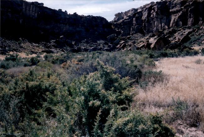 |
Appendix 3.1, Figure1. Head of drainage at base of Chacra Mesa near soil sample #4 (Good potential: D-1). |
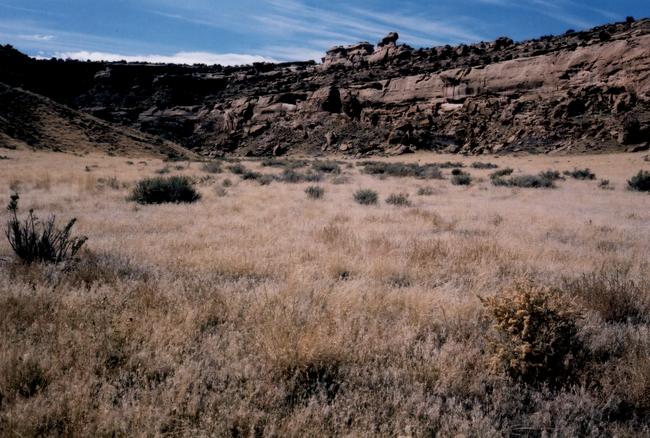 |
Appendix 3.1, Figure 2. Where drainage at base of Chacra Mesa begins to fan out near soil sample #5 (Good potential: D-1). |
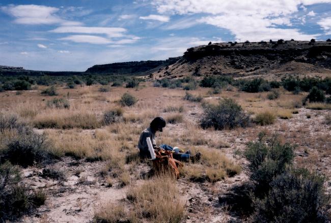 |
Appendix 3.1, Figure 3. Drainage (D-1) at base of Chacra Mesa approaching floodplain of Chaco Wash. Near soil sample #7. |
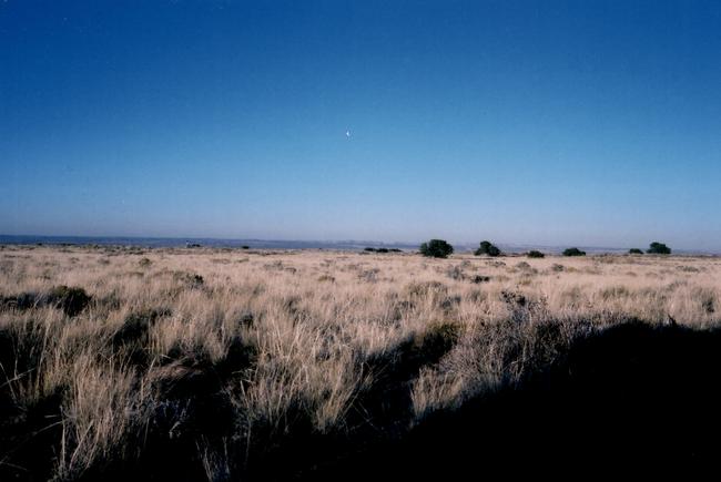 |
Appendix 3.1, Figure 4. Upland loamy soils (UL-L) of Chacra Mesa from the west end of the mesa looking east towards mid-mesa. Poor agricultural potential based on poor run-off collecting possibilities. |
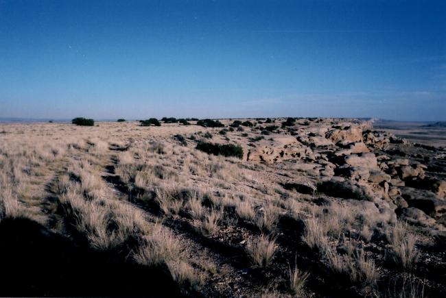 |
Appendix 3.1, Figure 5. Looking east along the south edge of Chacra Mesa. Bench areas (B-1) below would collect good quantities of run-off moisture. Uplands (UL-L, etc.) and mesa outcrop-talus (MOC-T) types pictured have poor potential for agriculture. |
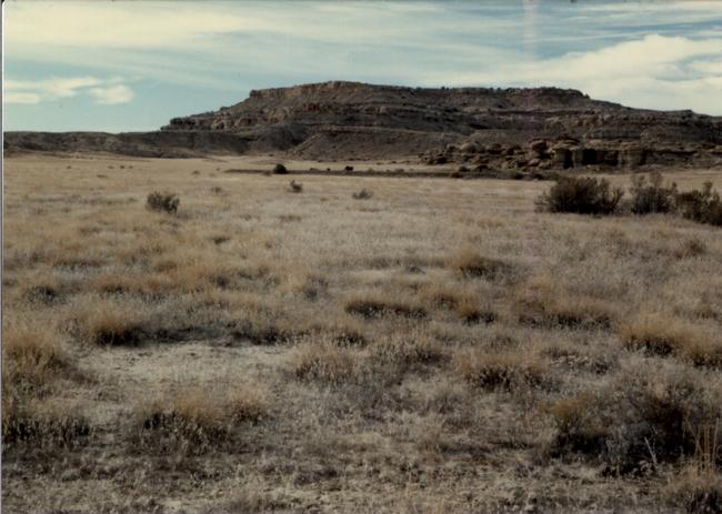 |
Appendix 3.1, Figure 6. Gentle dissected drainage (D-1) with good agricultural potential on east section of South Addition. Taken from park boundary looking west into South Addition (grazed). |
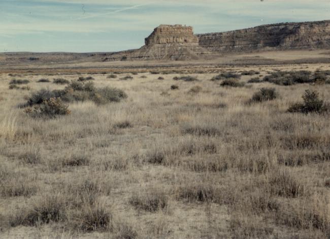 |
Appendix 3.1, Figure 7. Same type and location as Figure 6, looking east into park (protected from grazing). Note addition of saltbush and considerably greater density of grass species. |
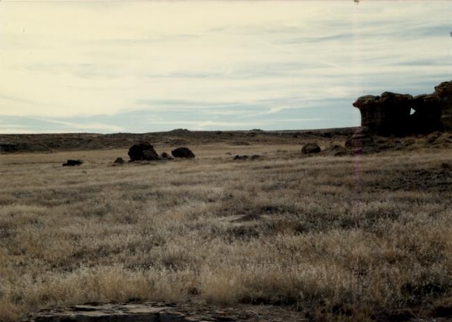 |
Appendix 3.1, Figure 8. Gentle dissected drainage (D-1) of South Addition. |
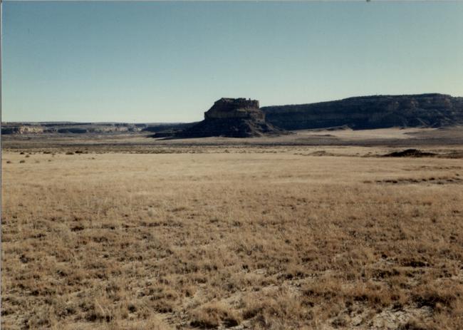 |
Appendix 3.1, Figure 9. Principal drainage (D-1) of east section of South Addition. |
 |
Appendix 3.1, Figure 10. East section of South Addition. Areas illustrated with poor potential are shale badlands (BL) with little vegetation, dissected hills with thin soils (BL-RH), and rolling hills with clay (RH) or sand (RH-S) soils. Flat areas of the drainage basin (left and mid-distance) are D-1 and have good potential. |
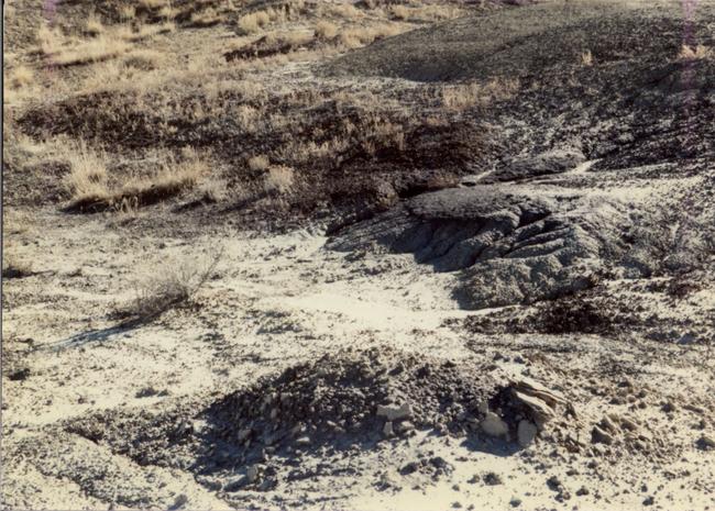 |
Appendix 3.1, Figure 11. Tight, fine-textured soils of shale outcrop support little or no vegetation, but act as excellent water collectors for areas below. |
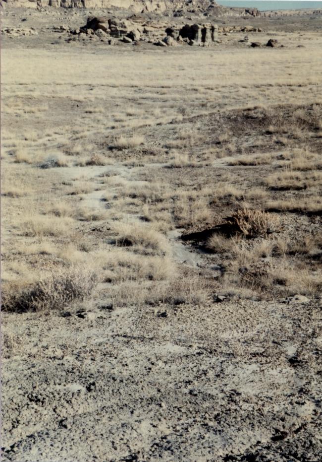 |
Appendix 3.1, Figure 12. Another example of an area with tight, fine-textured shale outcrop soils that support little or no vegetation, but act as excellent water collectors for areas below. |
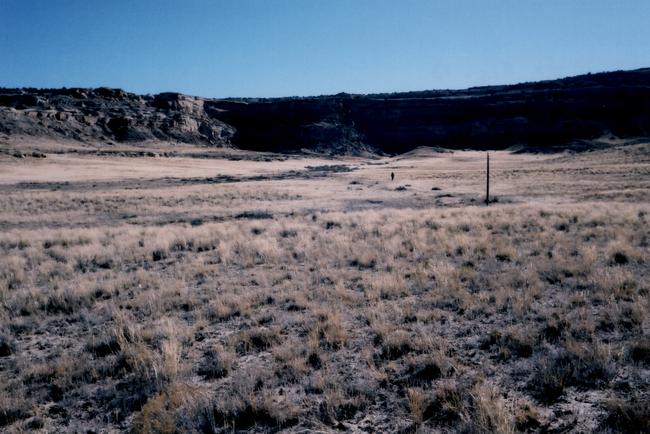 |
Appendix 3.1, Figure 13. West section of South Addition. Lowlands (L-2) with fair agricultural potential and drainage (D-1) with good potential. |
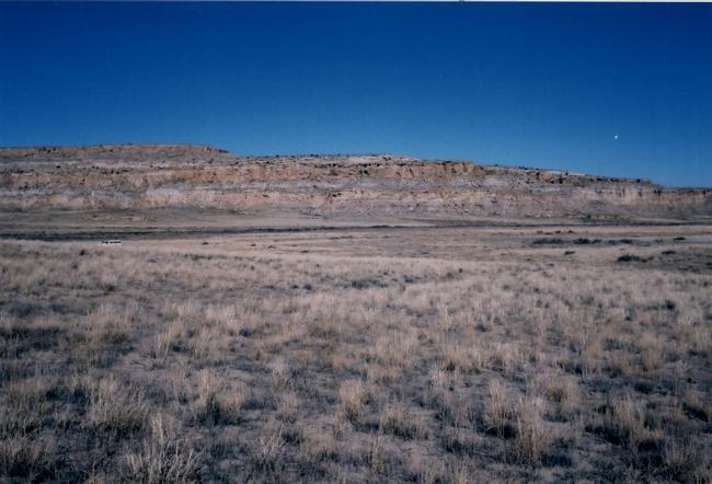 |
Appendix 3.1, Figure 14. West section of South Addition. Looking from sandy, rolling hills (RH-S) with poor potential west onto lowlands and drainage areas that are good candidates for farming. |
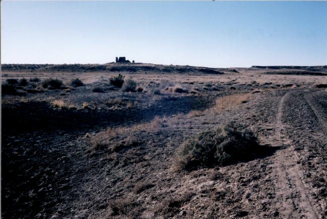 |
Appendix 3.1, Figure 15. Lowlands (LF) at Kin Klizhin with saltbush and alkali sacation (fair agricultural potential). |
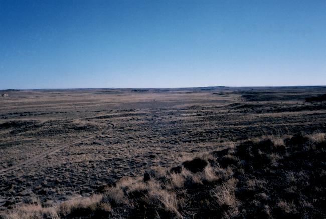 |
Appendix 3.1, Figure 16. Looking south from uplands (UL) with abundant alkali sacaton at northwest corner of Kin Klizhin addition, across slopes and lowlands of good (LG), fair (LF, LD-1), and poor (LUD) potential. |
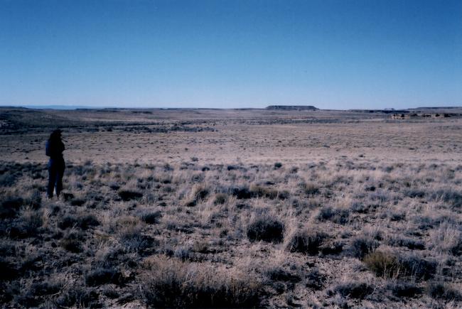 |
Appendix 3.1, Figure 17. Looking across lowlands of fair (LU-2) and good (LU-1) agricultural potential to Kim-mi-ni-oli Wash. Near the wash (LD-1) potential is fair. |
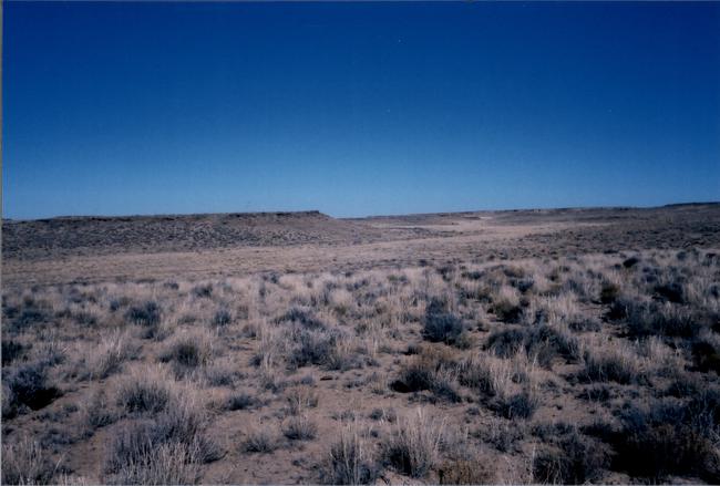 |
Appendix 3.1, Figure 18. Kin Bineola Addition. In mid-distance is an undissected drainage with good agricultural potential. |
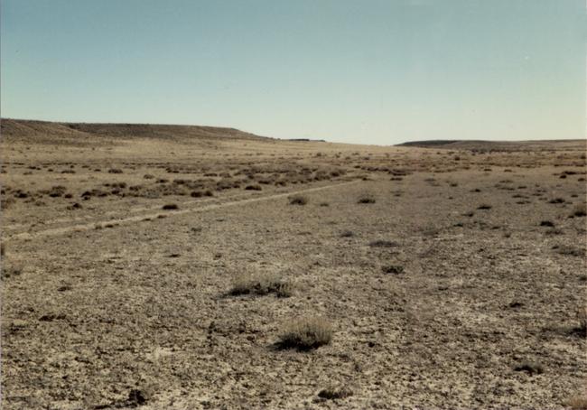 |
Appendix 3.1, Figure 19. At Kin Bineola Addition, looking south across clay flats (D) with very low densities of alkaline tolerant annuals and shrubs (very poor farming potential ) to shrub/grass upland slopes in the distance. |